
Hoon Han is a Professor of City Planning within UNSW Sydney’s School of Built Environment and Associate Director of its City Futures Research Centre.
Much of his academic work is focused on economic geography, property markets and ‘smart’ cities, contributing to the field of spatially integrated social science, “which systematically tests, explores and monitors changes in geographic location, distribution and patterns across cities and regions”, Prof. Han explains.
“My research draws on spatial modelling, machine learning and statistical techniques,” he says. “More specifically, it aims to contribute to spatially integrated social science – in particular, the dynamic changes occurring in response to constraints and opportunities within cities.
Since 2015, Prof. Han has been the recipient of several competitive research grants including international contracts; they include funding for:
- an open innovation workshop for Korea-Australia smart cities service trade from the DFAT’s Australia-Korea Foundation Grants Program (2015);
- a knowledge exchange network for Australian and Indian smart cities from DFAT’s Australia-India Council Grants Program (2016);
- a Rapid Analytics Interactive Scenario Explorer, co-funded by CRC-Spatial Information (2016);
- review and improvement of composition-adjusted methodology in calculating city-wide median house prices across Australia (2017);
- a cfip 3-D virtual prototyping system backed by the Research Infrastructure Scheme (2018);
- development of a Google Map-compatible AR-based Indoor Pedestrian Navigation Platform (2019); and
- Value Australia – Sharpening our land and property decisions with Artificial Intelligence (2019).
Prof. Han actively disseminates his research findings, with academic papers accepted into 100-plus publications – scholarly books, book chapters and journal papers – and cited more than 2,000 times worldwide (Google scholar).
Currently, he on the Editorial Boards of journals Housing Studies (Taylor & Francis) and serves as a Manuscript Editor of Spatial Information Research for academic publisher Springer.
Prof. Han is part of the PlA PlanTech National Working Group; sits on the Academic Committee of the NSW Government’s Smart Spaces Strategy; and is a Member of the Planning Institute of Australia as well as President of the Korean Academy of Scientists and Engineers in Australasia (KASEA).
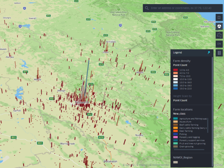
Map showing land-use density in NSW’s Namoi region. Credit Hoon Han, UNSW City Futures Research Centre
Awards and accolades
His work has been recognised with a string of awards and accolades.
- a Cutting Edge Research and Teaching award (with City Futures Research Centre – UNSW, QUT Design Lab, Omnilink and FrontierSI https://frontiersi.com.au) for The Rapid Analytics Interactive Scenario Explorer (RAISE) Toolkit (2020), a spatial data tool that enables users to quickly estimate and visualise property value;
- a Best Industry-Led Smart City Award (a team awards led by Prof. Chris Pettit) from the Committee for Sydney (2017);
- a Smart City Service Award at World Smart City Week (WSCW) in Seoul, Korea, nominated by the DFAT Australian Embassy, Seoul (2017);
- the Dean’s Research Excellence Award for UNSW’s School of Built Environment (2016);
- a Best Paper Award at the Knowledge Cities World Summit in Daegu, Korea (2015); and
- an international academic award for a significant contribution from the Korea Planning Association (2014).
A passion for planning: early accomplishments
Hoon Han’s interest in AI, computer modelling and geomapping is part of a broader research interest in planning. His initial research focus was on urban centres but in recent years, he has expanded this focus to include sophisticated, data-driven tools for urban and regional planning.
After completing a Masters of Planning at the University of Queensland (UQ), Brisbane, Han enrolled in a PhD at the same institution, taking out his doctorate in 2004 and netting an award for best published paper of the year in the Housing Studies Review Journal.
Dr Han held teaching and researcher positions at UQ from 2004 until 2009, then at Griffith University in South-East Queensland from 2009 to 2011, netting Griffith’s inaugural Vice Chancellor’s Research Excellence Award in 2010 for his ‘Healthy City’ project.
He joined the academic staff at UNSW Sydney in January 2011 as a Senior Lecture, being promoted to Associate Professor in 2017 and to full Professor in 2022.
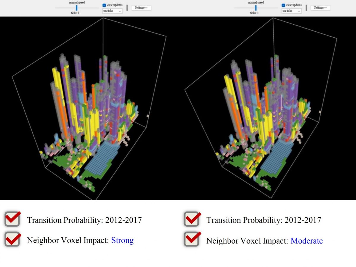
Colour-coded 3-D maps showing changes in Sydney CBD floorspace use under differing scenarios. Courtesy of Prof. Hoon Han, City Futures Research Centre, UNSW
An AI-enabled valuation toolkit
Prof. Han was both Co-Chief Investigator and inventor on the recently completed $7 million CRC-P project Value Australia (2020-2022) to develop a national suite of data and software products for valuing land and property – Australia’s single largest asset class.
The project team, including Prof. Han and City Futures Research Centre Director Professor Chris Pettit, combined research, extensive data assets from public and private organisations, and state-of-the-art analytics and AI to deliver digital valuation models and tools covering a broad range of land and property types across urban, peri-urban and regional Australia.
Their work resulted in a suite of secure, scalable, commercially viable valuation products – predictive infrastructure sequencing and integrated city-growth models; value creation models for critical infrastructure projects; infrastructure value-capture financial models; and economic feasibility models to calculate likely returns on property development – that, together, ‘provide better information sooner to homebuyers, investors, businesses and governments whilst reducing costs and risks’.
“The project involved developing a novel automated valuation toolkit using AI, which the Commonwealth Bank of Australia has implemented,” Prof. Han says. “The research outcomes successfully led to commercialisation.”
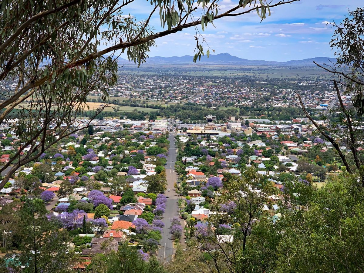
Tamworth, a regional city in north-western NSW. Credit: Shutterstock
A national map of sea and tree change
A recent research project funded by the National Housing Research Program (NHRP), national-housing-research-program from the Australian Housing and Urban Research Institute saw Prof. Han mapping residential movements across Australia, and how socioeconomic and housing characteristics changed
The National Housing Research Project, supported by around $100k in grant funding, was “a major project all about promoting regional migration and labour markets”, Prof. Han explains.
“I used ABS Census and Household, Income and Labour Dynamics in Australia (HILDA) data to trace individual households that moved from the city to regional areas, comparing their status over five years using longitudinal data compiled by University of Melbourne which traced, every year, whether people moved and how their socioeconomic characteristics – daily activities, consumption patterns and so on – changed over time using longitudinal data.”
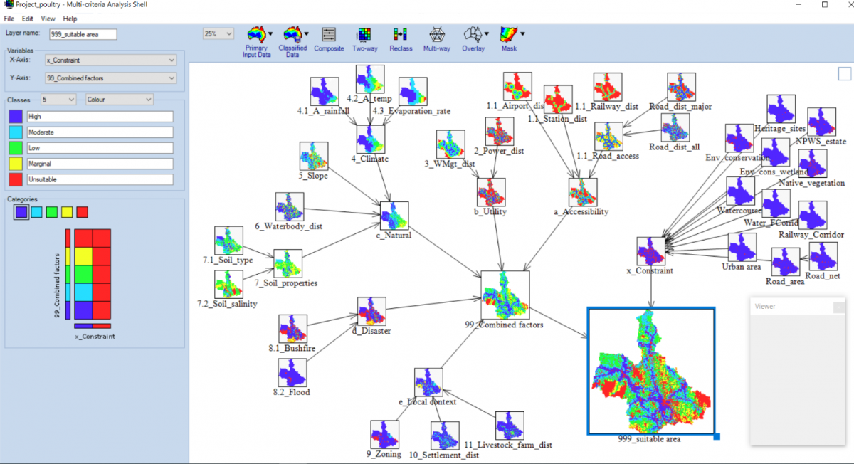
Namoi project MCDM tool, showing results for poultry. Credit Hoon Han, UNSW City Futures Research Centre
A land-use suitability decision-making tool to support agribusiness development
In a soon-to-be-completed project with FFS, Prof. Han and research assistant Ripan Debnath at UNSW collaborated with Namoi Unlimited, a Joint Organisation of four Northern Rivers-area councils keen to support agribusiness development in this rich agricultural region of NSW.
“This project is very closely related to my primary field of expertise, city planning – applied to a regional area,” Prof. Han says. “It is basically looking at land suitability for agricultural business within the Namoi region of NSW, using multi-criteria analysis to assign weights to various factors. Once we finalise this tool, planners can use it to determine future agribusiness locations.” The data-enabled maps could also prove useful to planners of agrifood-related infrastructure – transport, energy, water, services and the like, he says.
More than a static snapshot, the Namoi maps can be updated to reflect new and additional data –potentially employing AI to automate this process.
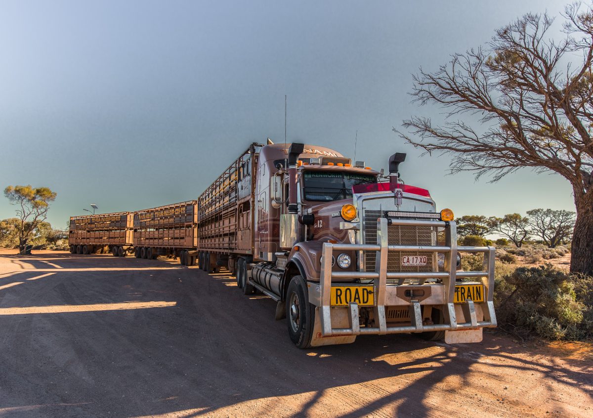
Semi trailer carrying livestock. Alice Springs. Eight supply chains account for more than 50% of greenhouse-gas emissions globally – and the number-one offending supply-chain is food. Freight, including food and agriculture freight, comes in at number eight. Credit: Credit Serge Goujon/ Shutterstock
Optimising agrifood transport routes and supply chains
AI and geospatial mapping could also be used to optimise freight transport routes and streamline agrifood supply chains, Prof. Han contends. A freight-route optimisation tool could help cut costs for producers while reducing food loss and harmful emissions.
“Different fresh products have varying life cycles and expiry dates, so there is a lot of food waste in the journey from farm to retailer,” Prof. Han explains. “And different foods require different conditions in transit – for example, temperature is a big issue. Take bananas, for example – they have a short ripening window, so the question might be, ‘Can they be transported interstate and still arrive in good condition?’
Answering this question isn’t easy; it involves a series of complex decisions, says Prof. Han. But big data and AI could help producers make such decisions quickly and with greater accuracy.
“There’s a lot of data about agricultural freight – on things like loading and unloading times, in-transit conditions including time and temperature, length of time spent in warehouse storage, etc. And we could use this data, and AI, to decide things like whether to send perishable produce interstate or overseas, or whether to sell it locally,” Prof. Han says.
“I’m not an expert in fresh produce but I am an expert in data-mapping and AI. I want to engage with agricultural producers to help them design ways to optimise fresh-food freight delivery routes. If industry can provide food supply-chain data, we can produce optimised routes.”
Prof. Han is keen to work with FFS on future projects in this space.
In real life…
When Hoon Han isn’t data-crunching or creating multi-coloured geospatial maps, you might find him in the garden, landscaping, weeding or doing a spot of woodwork; or in the kitchen, whipping up some Asian cuisine; or pursuing his extra-curricular interests in astronomy and quantum physics.
Lead image: Professor Hoon Han: Prior to working with Namoi Unlimited and FFS, Prof. Han was engaged on a $7m government project mapping residential movements nationally. Image courtesy of Hoon Han, UNSW