Challenge Despite growing momentum to digitally transform Australian agriculture, a critical data gap persists: the lack of accurate, spatially-referenced baseline information about the location, area, and grower details of individual commercial crops. This absence hinders progress across multiple domains including biosecurity, market access, sustainability, and traceability. While some foundational steps have been taken, particularly for horticultural tree crops, more comprehensive data integration is urgently needed to fully unlock the potential of digital agriculture.
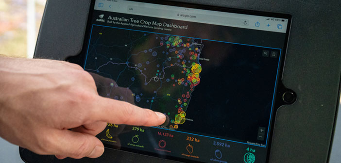
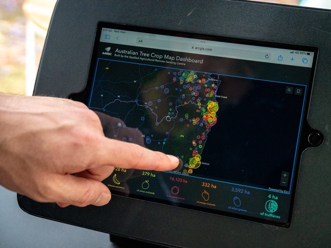
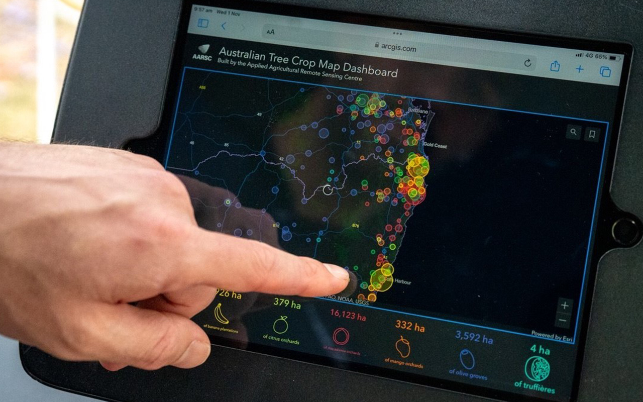
Solution Australian horticultural industries, including avocado, macadamia, citrus, olive, and banana, have collaborated to develop the ‘Australian Tree Crop Map (ATCM) Dashboard’, a national spatial dataset that accurately identifies the location and area of all commercial orchards larger than one hectare. Built to national mapping standards and openly accessible, the ATCM represents a landmark achievement in multi-industry data sharing and coordination. This project will now expand the map’s value by linking each orchard polygon with detailed industry-specific information such as crop variety, planting dates, management practices, and productivity metrics. By enriching the spatial layer with these attributes, the platform becomes a dynamic decision-support tool for stakeholders across the supply chain.
Impact The enhanced ATCM will support a wide array of agricultural outcomes, including improved traceability, market access, biosecurity preparedness, yield forecasting, and assessments of carbon storage and drought resilience. It sets a new standard for spatial data use across Australian agriculture, showcasing the power of collaboration and open-access platforms to drive innovation and build resilience across the sector. Ultimately, this initiative bridges the gap between spatial intelligence and on-ground productivity, reinforcing Australia’s global leadership in agri-digital infrastructure.