Skip to content
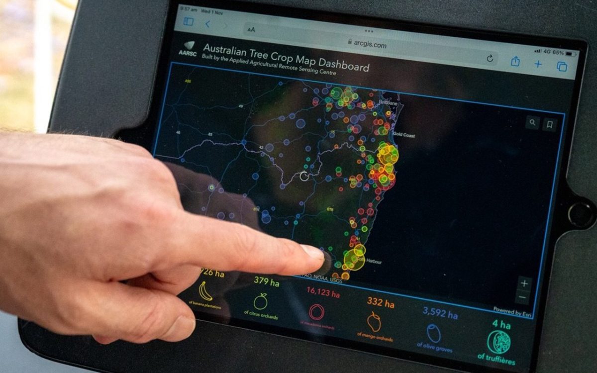
Smart, sustainable, resilient food systems require smart, sustainable, resilient transport systems at the location, regional, national and international scale. The development of short-term and long-term transport, land use and infrastructure plans to support such systems is contingent upon effective freight scenario planning, which encompasses potential drivers of change in the freight task and future trends in supply chains, including technology, demographics, climate change energy sources and emissions, and unplanned events. However, collecting accurate freight data poses significant challenges and is often expensive. Existing freight models lack the necessary flexibility to incorporate and reflect dynamic changes due to the nature of one-time data collection. Consequently, these limitations hinder a comprehensive assessment of the impacts of infrastructure and land use plans. Australian horticultural industries, including avocado, macadamia, citrus, olive, and banana, have collaborated to develop the ‘Australian Tree Crop Map (ATCM) Dashboard’, a national spatial dataset that accurately identifies the location and area of all commercial orchards larger than one hectare. Built to national mapping standards and openly accessible, the ATCM represents a landmark achievement in multi-industry data sharing and coordination. This project will now expand the map’s value by linking each orchard polygon with detailed industry-specific information such as crop variety, planting dates, management practices, and productivity metrics. By enriching the spatial layer with these attributes, the platform becomes a dynamic decision-support tool for stakeholders across the supply chain.
Go to Top